
Menomonee Falls ZIP Directory Coverage
Two postal codes appear in official USPS assignment material for Menomonee Falls. ZIP code 53051 is the primary standard code tied to local street addresses. ZIP code 53052 is also assigned to Menomonee Falls in the cited USPS Domestic Mail Manual list, but the current delivery type and exact service area were not confirmed in the official material reviewed. Treat 53052 as a lead to verify, especially when a post-office box is involved. Neither code draws the legal village line.
| ZIP | Local coverage evidence | Postal use | Research caution |
|---|---|---|---|
| 53051 | USPS assignment and county public-health cross-check name Menomonee Falls | Principal code for standard local street addresses | Service area is not the Village boundary |
| 53052 | USPS DMM also assigns it to Menomonee Falls | Verify the precise address or box in the current USPS tool | Current delivery classification was not confirmed |
The county public-health ZIP table calls its ZIP values estimates and warns that city names may be incomplete. That makes it useful as a cross-check, not a boundary source. For one address, the current USPS ZIP Code Lookup is the postal authority. Use the county parcel map or Census boundary map for village inclusion. This division of roles is central to an accurate Menomonee Falls ZIP code directory.
Search Menomonee Falls Postal Fields
The USPS tool offers three different questions. “By Address” standardizes a full delivery address. “By City & State” returns codes associated with a place name. “Cities by ZIP Code” reverses a known code to its accepted city names. A city-level result still does not confirm a person or company, so use the full street and unit whenever possible.
| Mode | Fields | Best use |
|---|---|---|
| By Address | Company optional; street, city, state; unit when needed | Standardize one delivery address |
| By City & State | Required city and state | See codes assigned to Menomonee Falls |
| Cities by ZIP Code | Required ZIP code | Check accepted postal city names |
The official USPS search screen shows these choices in one place.
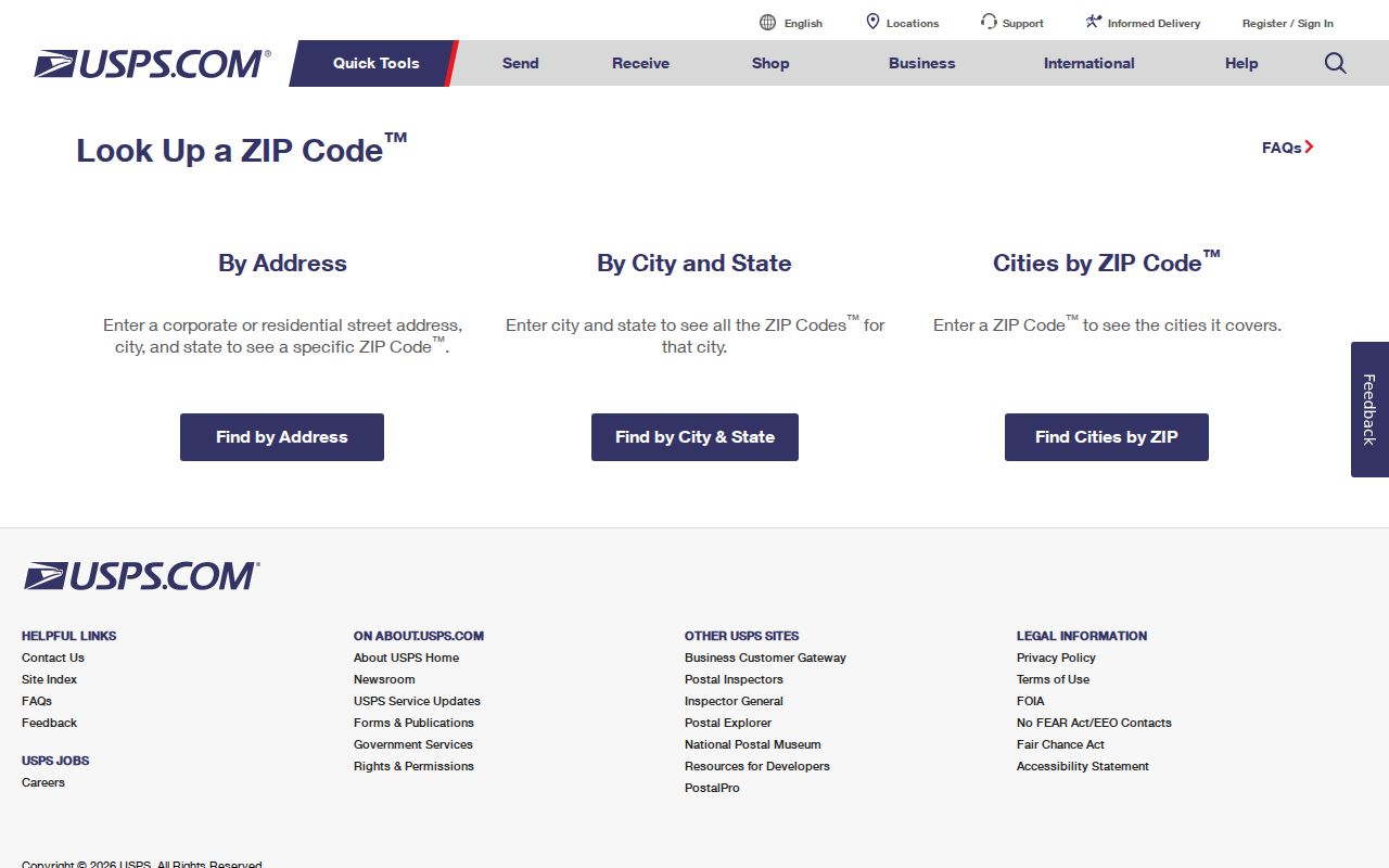
The captured interface helps distinguish a complete address search from a broad city or reverse-ZIP query. Preserve the standardized result exactly before checking other records.
Map Menomonee Falls ZIP Results
A postal city line answers a mail-routing question. The Waukesha County Menomonee Falls map and the Census BAS village map answer a municipal-boundary question. Check both when an address sits near an edge, carries an unexpected postal city, or appears in a source that uses an older community label.
The Waukesha County Map adds parcel and road context to that comparison.

The map screenshot shows the right geographic handoff: locate the address and parcel, then compare its position with the village line. No confirmed ZIP filter was found in the visible map controls, so do not claim one.
Find Menomonee Falls Residents by ZIP
A ZIP code directory narrows geography before a record search. It does not supply a public household roster. USPS is the dedicated ZIP-keyed source. County Tax Listing accepts a tax key, address, or name in its simple prompt, while Parcel Inquiry exposes tax-key and street-address modes. Neither visible interface established a ZIP-wide search. MyVote includes ZIP in its address form, but returns polling and election information, not names at that address.
- Submit the complete address through USPS By Address. Keep the returned spelling, unit, city, state, and ZIP.
- Enter that street address in Waukesha County Tax Listing and Parcel Inquiry. Record the tax key, situs address, and legal description.
- Compare the mapped parcel with the county and Census village lines. Note any mismatch instead of silently changing the postal result.
- Use MyVote only for election logistics or a known person’s individual verification. A broader voter-file request goes through Badger Voters and its estimate, payment, and releasable-field rules.
Once the search reaches a named road, use the Menomonee Falls street directory for the full address and parcel sequence. That shift keeps ZIP geography from being mistaken for proof of residence.
Verify Menomonee Falls Code 53052
The historical USPS assignment is real, but it does not justify a detailed claim about where 53052 runs today. The research did not confirm a current sample address, a delivery classification, or an official polygon for that code. Enter the exact address or box in USPS. If the result is ambiguous, ask the post office rather than treating an archived table as a current parcel map.
This is an important Menomonee Falls ZIP code directory limit. It preserves a useful second code without inventing neighborhoods, streets, or a boundary. The same caution applies to third-party ZIP maps, which may use approximate shapes or stale city labels.
Note: Keep 53052 as a verified postal lead, but confirm its current use with USPS before attaching it to a resident record.
Compare Menomonee Falls Parcel Addresses
County parcel records separate the situs address, where the parcel is located, from the owner mailing address, where tax correspondence goes. Either field can carry a ZIP, but they answer different questions. A mailing ZIP outside Menomonee Falls does not move the parcel. An owner name attached to a parcel also does not prove that the owner occupies it.
Parcel Inquiry asks for a tax key or for house number, direction, and street name. The county supplies common abbreviations such as AV, BL, CIR, CT, DR, LN, PKY, PL, RD, ST, TER, TR, and WAY. Try the county form before dropping part of the street name. Tax Listing’s visible prompt accepts tax key, address, or name and links to property details and the parcel view.
Keep fields distinct. Postal ZIP, parcel situs, owner mailing address, village boundary, and residence are separate facts. Record each with its source.
Historic Menomonee Falls ZIP Clues
Modern ZIP codes should not be added to an old directory entry without evidence. Village history says street signs went up and all buildings received numbers for the first time in 1935. Records from before that change may use a lot, owner, rural route, landmark, or road name rather than today’s numbered address. The village also completed six annexations in 91 days beginning in October 1958, so the same site can move from a Town label to a Village source without moving on the ground.
Preserve the old wording. Then compare it with plats, Sanborn maps, property histories, county deeds, and the current parcel legal description. No official Menomonee Falls ZIP realignment history was found, so numbering and annexation facts must not be presented as proof of a postal change.
Menomonee Falls ZIPs Versus Village Limits
Menomonee Falls is a village, not a city and not the Waukesha County seat. A ZIP code is a postal routing device, while village limits govern local jurisdiction. ZIP service may cross a municipal line, and a postal place name may cover an address outside that named municipality. That is why a resident search should compare USPS formatting, the parcel map, and the official village boundary instead of accepting one city line as all three.
- ZIP and ZIP+4
- The five-digit code identifies a delivery area; the added four digits narrow a route, building, or group of addresses.
- PO-box ZIP
- A code or use centered on post-office boxes rather than ordinary street delivery. Verify the current class with USPS.
- Unique ZIP
- A code assigned to one organization with enough mail volume. No unique Menomonee Falls code was established here.
- Carrier route
- A delivery path within a ZIP. It is not the same as a village ward, parcel block, or neighborhood.
A careful Menomonee Falls ZIP code directory can route research while respecting those limits. It cannot identify occupants by itself, and it should never turn an estimated ZIP table into a claim about village residency.
Log Menomonee Falls ZIP Evidence
Keep a short record for every address checked: the address as entered, the USPS-standardized form, the returned ZIP code and postal city, the parcel situs, the tax key, the municipal map result, the source date, and any mismatch. This turns a quick postal query into evidence that can be checked later. It also prevents an owner mailing address from replacing the physical parcel address in notes.
If USPS returns several matches, add the unit and verify the street direction. If Parcel Inquiry rejects the same wording, try the county’s stated road abbreviations and confirm the tax key through Tax Listing. Near a boundary, keep the postal and municipal conclusions on separate lines. The Menomonee Falls ZIP code directory is most useful when it shows where sources agree and where they answer different questions.
Historical sources deserve their own row. Copy the community label, street form, directory title, page, and date exactly. Then document the map, plat, deed, or property-history source used to connect it with a modern parcel. Never hide the translation step. That practice matters around Fussville, the former Town of Menomonee, and roads whose names changed. It also makes a later correction much easier when a current ZIP assignment or interface changes.