
Menomonee Falls Previous Residents Sources
The backward trail changes keys as it crosses time. Current parcel tools begin with a street address or tax key. The modern deed index is fully indexed from 1994 forward. Earlier work turns to legal descriptions, historical land volumes, city and telephone directory references, census schedules, newspapers, and property files. Each layer supports a different part of the story.
| Source | Local years | Custodian | Evidence supplied |
|---|---|---|---|
| Tax Listing and GIS | Current cycle; historical depth not stated | Waukesha County; Village assessor for detail | Tax key, situs, owner, mailing address, legal description |
| Recorded documents | Fully indexed from January 1, 1994 | Waukesha County Register of Deeds | Parties, type, date, instrument or book/page, legal description |
| Historical land indexes | 1848–1994 | Register of Deeds online indexes and office | Tract, subdivision, and condominium postings |
| Directories and census | Cited directories 1890–1936; local census film 1840–1920 | MFPL and Wisconsin Historical Society | Dated name, address, phone, business, or household context |
| Maps and property files | Sanborn 1910, 1925, 1949; files vary | MFPL and WHS | Building, street, lot, bibliography, and physical context |
A deed names legal parties, not every occupant. A directory can connect a name and address in one year, but the cited years do not form a complete annual run. Build an evidence log with the printed address, modern address if known, tax key, legal description, date, names, roles, page or instrument number, source, and a confidence note.
Start at a Menomonee Falls Parcel
Enter the current address in Waukesha County Tax Listing. Copy the tax key, exact situs, current owner, owner mailing address, legal description, subdivision or lot, assessment, and View Parcel link. Do not merge the situs and mailing fields. The first locates the land; the second receives tax correspondence.
Open Parcel Inquiry with the address or tax key. Check the boundary, road spelling, nearby tax keys, corner-lot shape, and signs of a split or merged parcel. The legal description is the most durable bridge to prior owners because street names and numbers can change.
Menomonee Falls Deeds Before 1994
The Public Access Document Search provides fully indexed land documents from 1994 forward. Results may show image access, instrument or book/page, filing and recording dates, document type, party name, legal description, and status. Certified copies remain a separate office or mail service.
The historical tract index supplies the older bridge.
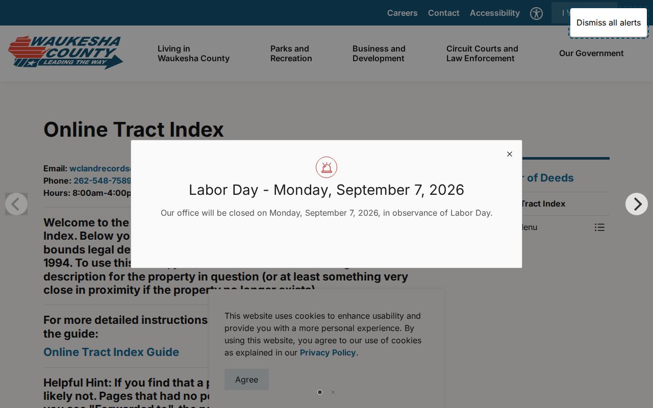
The captured page points to the 1848–1994 tract, subdivision, and condominium volumes. Start with a legal description, pick the proper range, and follow “Forwarded to” to the next page. Omitted no-posting pages do not prove that records vanished.
Trace Waukesha County Past Owners
A grantor transfers an interest; a grantee receives it. Start with today’s parcel and move backward one recorded transfer at a time. Keep party role, date, legal description, and document identifier together. A matching surname is not enough, and an owner mailing address does not establish occupancy.
- Record the modern tax key, situs, owner, and full legal description from Tax Listing.
- Find the newest transfer in Public Access. Save parties, date, type, instrument or book/page, status, and image link.
- Search the grantor as an earlier grantee while checking that the same legal description follows the parcel.
- Before 1994, browse the correct tract, subdivision, or condominium volume and retain the old wording.
- Mark a gap when a split, estate, trust, or missing entry prevents a supported link.
- Grantor and grantee
- The party giving an interest and the party receiving it.
- Chain of title
- The supported sequence of transfers affecting one parcel.
- Legal description
- The lot, subdivision, condominium, or metes-and-bounds language that identifies the land.
- Instrument number
- The recorder’s identifier for a document, distinct from a parcel tax key.
The Register of Deeds search-tools page explains online and office routes. The office at 515 W Moreland Boulevard handles in-person and mail copies. Land Records is available at 262-548-7589 or wclandrecords@waukeshacounty.gov.
Menomonee Falls Numbers Changed in 1935
Village history records that street signs were installed and every building received a number for the first time in 1935. An earlier deed, directory, or newspaper may identify the same place by owner, lot, rural description, or road. Preserve that old label before translating it.
The first Village-wide plat, prepared in 1887, contained 117 parcels. Use that plat, the legal description, Sanborn sheets, adjacent lots, and a property file to test continuity. Fond du Lac Avenue also became Appleton Avenue, so both names belong in an old-source search.
Note: Never add a modern street number to a pre-1935 source unless a map, plat, deed, or property file supports the match.
Previous Residents Across Menomonee Jurisdictions
Beginning in October 1958, Menomonee Falls completed six annexations of the Town of Menomonee in 91 days. A building could stay put while its government label changed. Search Town and Village forms in deeds, news, directories, minutes, and permits before deciding two references concern different places.
That switch is not proof of a postal change. It is a records clue. Pair it with the dated source, current parcel boundary, and legal description. It may explain why previous residents appear under a Town heading in one source and a Village heading in the next.
Map Older Menomonee Falls Houses
The Maude Shunk Local History Room lists Sanborn fire-insurance maps for 1910, 1925, and 1949 on microfilm. The Wisconsin Historical Society also provides the 1910 five-sheet set. These maps can show footprint, use, construction material, street width, hydrants, and utility context. They do not name every previous resident.
Compare a map date with a directory, census, deed, or tax record from the same era. The three dates straddle water-main work in the 1910s and sewer installation in 1924. A building on a Sanborn sheet plus a name in a dated directory is stronger than either source used alone.
Menomonee Falls Past Households
The verified January 1936 telephone directory covers Menomonee Falls, Lannon, Granville, Germantown, and Fussville. Its catalog labels include city, address, business, and phone formats, but the inspected pages showed business advertisements rather than a household alphabetical entry. Cite the exact page and community heading.
MFPL holds census microfilm from 1840 through 1920, local newspapers, family files, obituaries, funeral cards, yearbooks, church material, and property histories. Menomonee Falls News is online for 1905–1977 and held in the library for 1978 through June 2001.
- Record the directory name, page, printed address, phone, and community label.
- Compare the nearest census year for household names and approximate location.
- Check news, obituaries, and family files for relationships and address variants.
- Return to deeds and maps to keep the household evidence tied to the correct parcel.
The Menomonee Falls city directory collections page covers the shelf in depth. Use only the years and pages that help identify this address.
Lawful use. Research on previous residents supports genealogy, preservation, estate work, and personal curiosity. Never use the findings to harass, intimidate, or expose a protected address.
Ask the Menomonee Falls History Room
When the chain stops, the Maude Shunk Local History Room is the local fallback. It is on the library’s second floor and open during library hours. Stored family files, obituaries, business histories, and clipping files are available on request. Remote researchers may ask for a free limited lookup at historyroom@menomoneefalls.gov or by mail.
The library warns that allied surnames, variant spellings, and context can be missed when someone else searches, and copyright limits large copy runs. Ask for a specific surname, address, range, directory year, or newspaper item. WHS architectural inventory files can point to an exact Polk or Wright citation even when the volume is not online.
Note: Record an unresolved break as a gap; an absent online image does not mean the original record was destroyed.
Log Menomonee Falls Resident Evidence
Give each past-resident claim its own row. Include the historical address wording, modern address if supported, tax key, legal description, range or volume, instrument or book/page, grantor, grantee, document type, recorded date, image status, page URL, and confidence note. A second row can hold directory, census, newspaper, or obituary evidence for the same era. This layout exposes a missing transfer instead of burying it in a narrative.
Labels matter. A deed party may be a trustee, estate representative, business, or spouse rather than an occupant. A directory listing may be a business advertisement. A census location can be approximate, and an obituary may describe a former street. Keep those facts in the terms used by the source, then state any parcel match as an inference supported by the legal description, map, and date.
Village permit records can add construction dates when retained. The local portal identifies address, name, and parcel number as search keys, but its historical depth was not confirmed. For a gap, request a specific permit type and time range from Building Inspection; the Village policy notes that assessor and building requests may require 48 hours’ notice. Specific requests are more useful than asking for everything tied to a person.