
Menomonee Falls Neighbor Sources
Define a neighbor by visible parcel adjacency unless another source states a relationship. County GIS shows the physical block, Tax Listing connects an identifiable parcel with owner and tax fields, recorded deeds explain legal history, and community sources add public civic context. None creates a complete list of households. The table keeps each source within its documented role.
| Source | Block evidence | How to access it |
|---|---|---|
| Waukesha GIS Parcel Inquiry | Parcel polygons, address context, tax keys, nearby lots | Public address or tax-key lookup; no broad owner-name search |
| Waukesha Tax Listing | Owner, situs, mailing address, legal description, assessment | Run one identifiable parcel at a time |
| Register of Deeds Public Access | Recorded transfers and parties for each parcel | Fully indexed from 1994; older index method for earlier records |
| MyVote and Badger Voters | Election logistics or request-based voter data | No casual block roster; individual lookup needs name and birth date |
| Neighborhood Watch and civic directory | Public group contacts and local organization context | No public member roster was located |
An owner name is a parcel attribute. The mailing address may point elsewhere, and neither field proves who occupies a home. A condominium, common area, road parcel, exempt tract, or recently split lot can also look like an ordinary neighbor on a map. Record the labels exactly and mark any inference.
Plot Menomonee Falls Adjacent Parcels
The Waukesha County Parcel Inquiry accepts a tax key or a parcel address built from house number, direction, and street name. Select the target parcel first. Then note the visible tax keys for lots sharing a boundary, rear lots, corner parcels, and lots directly across the road.
The official parcel interface makes that starting point visible.
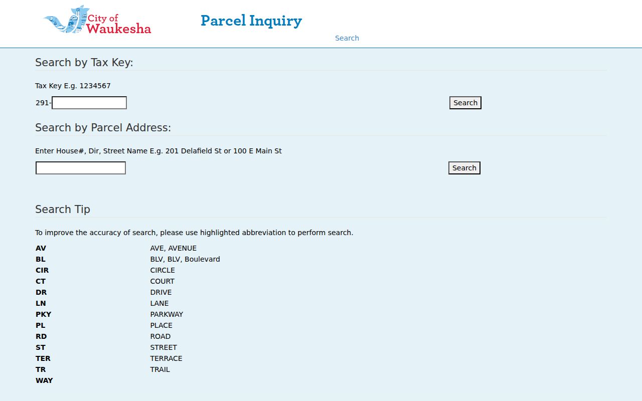
The screenshot supports an address-first workflow. It does not establish an automated buffer tool or a countywide owner-name mode, so those capabilities should not be assumed.
Map a Menomonee Falls Block
Move from map shape to record labels in a fixed order. This reduces false matches and keeps the immediate block distinct from a full street search. A rear parcel may be more relevant than the next postal number, while a corner lot may face a second road.
- Locate the target address and confirm the selected parcel boundary.
- Write down adjacent tax keys and exact situs addresses shown on the map.
- Run each key through Tax Listing. Keep owner, situs, mailing address, legal description, and assessment in separate columns.
- Use the legal description to identify common areas, condominiums, splits, or lots that only appear to adjoin.
- Open recorded documents only when a transfer or boundary question matters, and preserve party role and date.
Use MyVote only for a known person’s individual verification or address-based election information. It does not list everyone at a block address. For the full named-road chain, move to the Menomonee Falls street directory.
Menomonee Falls Voter Block Limits
MyVote Wisconsin separates two tasks. Its individual route requires first name, last name, and date of birth. Its address route uses street address, unit, city, and ZIP to return polling place, ballot, district, and election information. Neither mode is a public list of Menomonee Falls neighbors.
Broader voter data is requested through Badger Voters. The requester selects a dataset and jurisdiction, gets a count and cost estimate, pays, then downloads the permitted file. Wisconsin does not track party affiliation. For local poll books or election administration, contact the Village clerk; county results and election links come from the Waukesha County Clerk.
Note: A MyVote address result describes election logistics at a place, not the names of every person who lives on that block.
Menomonee Falls Neighborhood Watch
The official Village Neighborhood Watch page says the program began in 1986 with 60 homes and fewer than 100 people. It now describes about 154 groups covering roughly 4,500 homes or residents. Sgt. Christopher Bellows is the listed contact at 262-532-8720.
Those numbers show broad civic reach, not an open resident roster. Menomonee Falls Neighborhood Watch, Inc. is the nonprofit umbrella and offers board and contact routes, while its social group is closed. Ask about forming or contacting a group through the official channels. Do not infer that any owner, address, or person belongs to one.
Village Neighborhood Watch
Program history, group information, and police contact.
262-532-8720
Neighborhood Watch, Inc.
Local nonprofit board and general contact routes; no public member directory.
Browse Menomonee Falls Civic Groups
The Greater Menomonee Falls Chamber community directory lists public organizations and their contact details. Examples in the research include Neighborhood Watch, Lannon-Falls Lions Club, Knights of Columbus Council 4240, Optimist Club, and American Legion Post 382.

The captured directory is useful for finding organizations that serve the village. It identifies groups and public contacts, not the private household membership of your neighbors. Village boards, commissions, and committees add another public civic-name layer through posted meeting and appointment records.
Check Menomonee Falls Block Permits
Village building records can add dated, address-specific context around a block. The BS&A portal identifies address, name, and parcel number as search keys. Village permit categories include building, electrical, HVAC, plumbing, alteration, deck, fence, generator, pool, and wreck or raze work. The exact public result fields and historical depth were not established.
When the portal has no result, send a specific request to the Village custodian naming the address, date span, department, and record type. The Village public-records policy says assessor and building-inspection requests may need 48 hours’ notice. Wisconsin Public Records Law allows oral or written requests, but a clear written scope makes a block search easier to track.
Official Menomonee Falls Neighbor Records
Commercial neighbor tools may merge old addresses, relatives, phones, or duplicated names without showing the underlying record. Official sources are narrower, but their labels, dates, and custodians can be checked. Use them for parcel facts, recorded instruments, election logistics, permits, and public civic contacts.
| Source type | Strength | Main limit |
|---|---|---|
| Official parcel and deed records | Identified parcel, legal fields, dated instruments | Ownership is not occupancy |
| Official election and permit routes | Defined purpose and custodian | Not a household roster |
| Commercial matching category | May gather broad leads | Can be stale, duplicate, or wrongly matched |
For any result, save the source date and exact field label. Confirm important facts with the office that holds the record.
Protect Menomonee Falls Neighbors
Wisconsin public records remain subject to statutes, exceptions, and a balancing test. Safe at Home can replace an actual address with an assigned address for an eligible person facing a safety risk. Confidential-elector rules can also restrict disclosure. Court, police, vital, and voter records each have their own limits, and a missing name may be intentional.
Do not republish Social Security numbers, protected birth dates, financial data, confidential addresses, victim or witness details, or juvenile material. Utility and delivery records are not public block directories. If GIS and tax data disagree, ask the county or Village to clarify the parcel instead of filling the gap with a guessed household.
Lawful use. Use neighbor records for civic curiosity, reconnecting, and personal safety awareness. Never use them to watch, harass, intimidate, or expose another person.
Record Menomonee Falls Block Findings
Use one row per parcel when comparing Menomonee Falls neighbors. Record map position, tax key, situs, owner label, owner mailing address, legal description, assessment, and the date checked. Add a separate field for parcel type or uncertainty. This makes a condominium common area, road parcel, exempt tract, rear lot, or split parcel easy to distinguish from a home next door.
Only add a recorded instrument when it answers a clear question about transfer or boundary history. Save the document number or book/page, date, party role, legal description, and image status. Do not blend names from different parcels because they share a surname. When a civic group is relevant, cite the public organization page and contact, not guessed membership based on an address.
A block changes over time. Date every capture and return to the custodian for any fact that matters. Tax ownership can update after a transfer, map geometry can lag a recorded split, and group counts may change. An accurate neighbor lookup preserves the source’s scope, marks conflicts, and leaves protected or private household details out of the record.
For older block questions, the Maude Shunk Local History Room adds maps, plat maps, property histories, local news, yearbooks, and family files. Its Sanborn microfilm covers 1910, 1925, and 1949. Those sources can show how a street or building changed, but they must be paired with a dated name source before describing past neighbors. The library also offers a limited remote lookup for a focused request. Ask for one address, surname, source, and time span, since a broad request can miss spelling and community-name variants.
Village history adds two useful checks. Building numbers were first assigned across Village streets in 1935, and six annexations followed in 91 days during 1958. An older block can therefore use a different address form or a Town label even when the land did not move. Preserve the old terms and test them against the parcel’s legal description.